
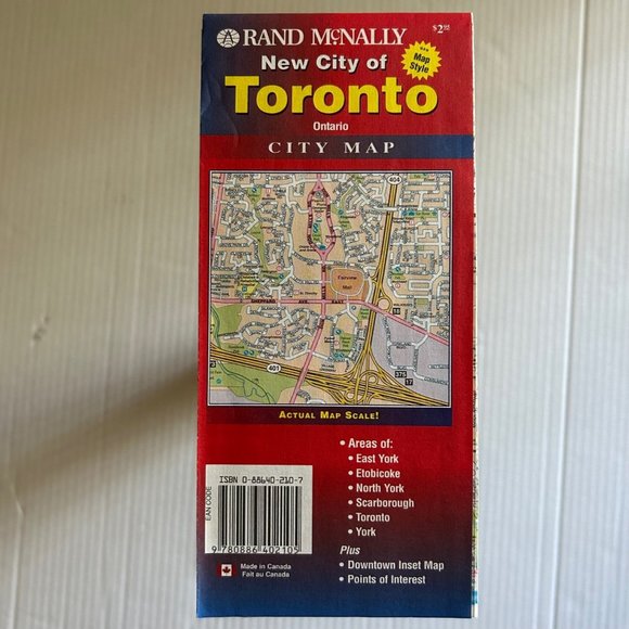
Folded Pocket Map of Toronto and Suburbs, Canada, 1997
NWT
$60
Pay in 4 interest-free payments of $15
with ![]() .
Learn More
.
.
Learn More
.
Size
Like and save for later
Add To Bundle
This is a Rand McNally's folded map of Toronto, Canada and suburbs. It shows all streets and highways, along with clearly indicated parks, points of interest, airports. The easy-to-use legend and detailed index make for quick and easy location of destinations.
• Full-color maps
• Clearly labeled highways
• Indications of parks, points of interest, airports, downtown & vicinity maps
• Attractions & Golf courses
• Easy-to-use legend
• Detailed & full street index
• Convenient folded size: 9½” X 4” folded; 40” X 28” unfolded
ISBN: 9780886402105
Shipping/Discount
Posh Protect: Buyer Protection Policy
Get your order as described or receive your money back. Learn More.


Find Similar Listings
About the seller

@nagimpex
Last Active: Jun 21
1064
Listings300+
Sold Listings1 day
Avg. Ship time29
Love NotesAbout the seller
@nagimpex
Last Active: Jun 21
