


Buckminster Fuller Institute Dymaxion Folding Map
NWT
$22 $25
Size
This item is sold out
Like and save for later
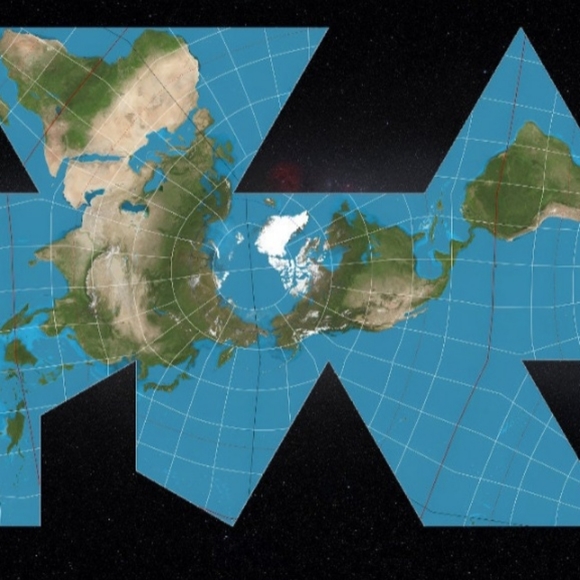
A Dymaxion map, a map projection developed by Buckminster Fuller, depicting a satellite view of the earth against a panorama of the night sky.
The map is 16 x 24 in. It is very high quality, professionally printed on premium, satin photo paper.
In 1946, Buckminster Fuller Institute patented a map of Earth which presents geographic information without breaks in any of the continental contours, or any visible distortion of the relative shapes or sizes of the land masses.
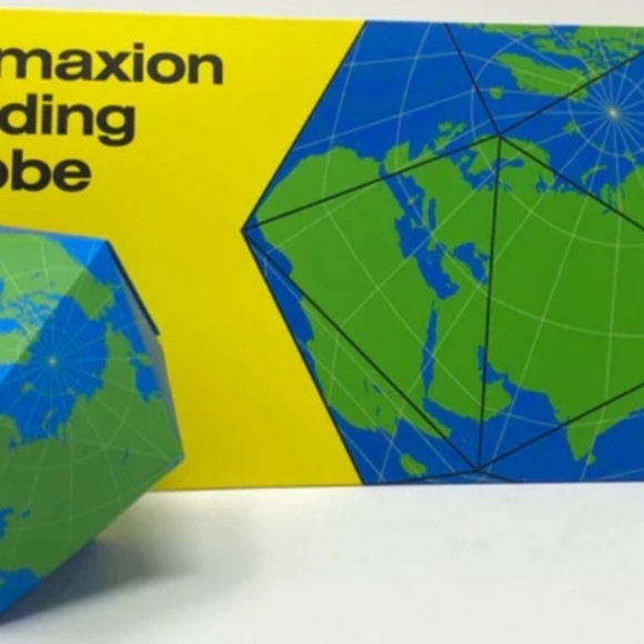
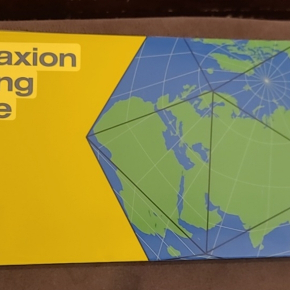
In 1954, the Dymaxion Projection as we know it today was hand drawn by architect, Shoji Sadao, the cartographer and collaborator behind the map. Designer Brendan Ravenhill has configured Fuller’s projection as a magnetic folding globe, a representation of Earth that easily transitions from flat to three dimensional. This edition of the map features only land & sea, depicting earth as an archipelago absent of its territories.
Fold it to form a geometric globe or unfold to reveal our flattened planet.
Buy one for $22 or multiples for a discount. Please inquire.
Shipping/Discount
Posh Protect: Buyer Protection Policy
Get your order as described or receive your money back. Learn More.

ewolfang
likes this


Find Similar Listings
About the seller

@elysehcohen
Last Active: May 04
312
Listings95+
Sold Listings1 day
Avg. Ship time8
Love Notes


About the seller
@elysehcohen
Last Active: May 04
312
Listings95+
Sold Listings1 day
Avg. Ship time8
Love Notes